Argo’s New Approach to Navigating the Caribbean
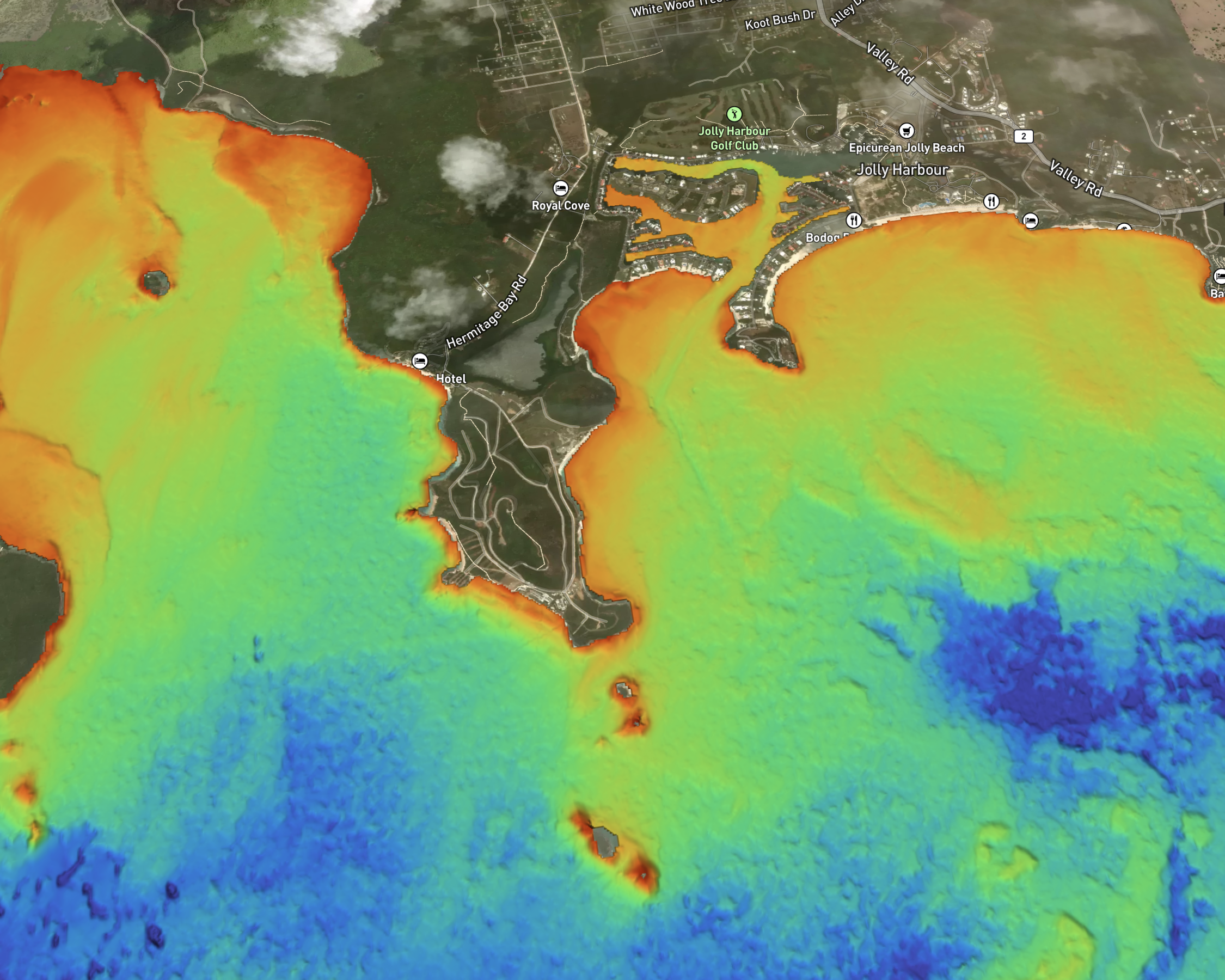
Argo Technologies is bringing new, high-resolution bathymetric data to marine navigation in the Caribbean—and it will be demonstrated publicly for the first time at the Annapolis Powerboat & Sailboat Shows.
For decades, much of the chart data available to recreational boaters throughout the Bahamas and Caribbean has relied on surveys conducted many years ago, in some cases dating back to the 1990s. Meanwhile, shoaling, shifting channels, changing coastlines and other underwater features can make these waters particularly challenging to navigate.
Argo is changing the way mariners see the bottom.
“What’s exciting about this is that boaters can finally see much more of the underwater terrain they’re actually navigating,” said Jeff Foulk, founder and CEO of Argo Technologies. “Instead of relying solely on a few depth numbers or lines on a chart, they can see the shape of the bottom and better understand what’s around them.”
Argo is incorporating extensive new bathymetric data into its navigation platform, combining high-resolution depth information with its existing charting, routing and depth-visualization technology. In shallow water, narrow passages, reef areas and popular anchorages, boaters will be able to see underwater terrain in significantly greater detail than traditional chart data provides in these areas.
The initial release will include the Bahamas and portions of the Caribbean, with additional coverage planned.
This is more than simply adding another chart layer. Argo is making detailed bathymetric information easier for boaters to see, understand and use when navigating complex waters.
Argo International represents the next evolution of Argo’s mission: bringing powerful navigation technology and high-quality marine data to boaters wherever they cruise.
Visitors at the Annapolis Shows will be among the first in the world to see Argo’s new Caribbean navigation capabilities.
Argo Navigation: Tent C 112
Learn more